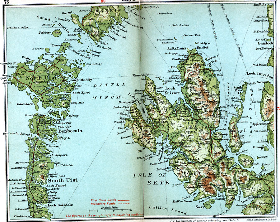
Description: A detailed travel map of the islands off the western coast of Scotland from 1908, showing the Isle of Skye, southern Harris, North Uist, Benbecula, and South Uist. This map shows first class and secondary roads, cities, towns, ports, ferry and steamer routes, rivers, terrain and coastal features of the area. This map uses contour–coloring to show terrain, with elevations shown in feet. Cities and towns on this map include Gairloch, Portree, Applecross, Bracadale, Broadford, and Obbe. Islands and coastal features include Pabbay, Soay, Raasay Island, Scalpay, Loch Boisdale, Little Minch, Loch Maddy, Sound of Harris, Loch Snizort, and the mountains Blaven, Storr Rock, and the Coolin Hills.
Place Names: United Kingdom, Benbecula, �Gairloch, �Harris, �Skye, �Uist,
ISO Topic Categories: inlandWaters,
location,
oceans,
transportation
Keywords: Skye and Uist, roads, �transportation, roads, inlandWaters,
location,
oceans,
transportation, Unknown, 1908
Source: J.G. Bartholomew, F.R.G.S., The Handy Touring Atlas of the British Isles Specially Prepared for Cyclists, Motorists, and Travellers (London, United Kingdom : George Newnes, Limited, 1908) 76-77
Map Credit: Courtesy the private collection of Roy Winkelman |
|