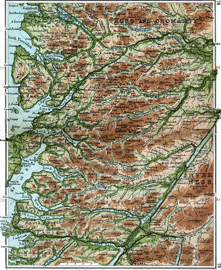
Description: A detailed travel map of western Scotland from 1908, showing portions of Inverness, Ross and Cromarty counties. The map shows first class and secondary roads, railways, cities, towns, ports, ferry routes, rivers, lakes, terrain and coastal features of the area. This map uses contour–coloring to show terrain, with elevations shown in feet. Cities and towns on this map include Gairloch, Beauly, Mallaig, Fort Augustus, and Fort William. Rivers, lakes, and coastal features include River Lochy, River Moriston, Strath Farrar, Strath Bran, Loch Torridon, Loch Carron, Loch Nevis, Loch Arkaig, Loch Eil, and the mountains Ben Wyvis, Slioch, Ben Eay, Craig Meggie, and Ben Nevis.
Place Names: United Kingdom, Inverness, �Knoidart, �Moidart, �Loch Eil, �Loch Maree, �Ross and Cromarty, �Sky
ISO Topic Categories: inlandWaters,
location,
oceans,
transportation
Keywords: Loch Eil and Loch Maree, roads, �transportation, roads, inlandWaters,
location,
oceans,
transportation, Unknown, 1908
Source: J.G. Bartholomew, F.R.G.S., The Handy Touring Atlas of the British Isles Specially Prepared for Cyclists, Motorists, and Travellers (London, United Kingdom : George Newnes, Limited, 1908) 78-79
Map Credit: Courtesy the private collection of Roy Winkelman |
|