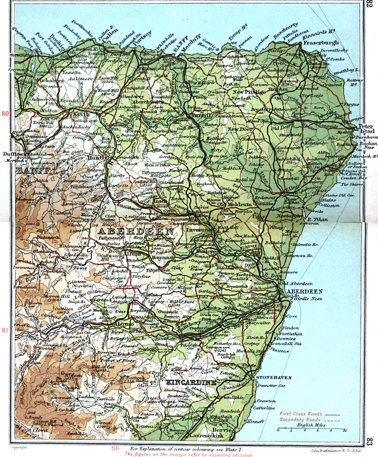
Description: A detailed travel map of Scotland in 1908, showing portions of counties Banff, Aberdeen, and Kincardine. The map shows first class and secondary roads, railways, cities, towns, ports, rivers, terrain, and coastal features of the area. This map uses contour–coloring to show terrain, with elevations shown in feet. Cities on this map include Kieth, Turriff, Peter Head, Aberdeen, Banchory, and Stonehaven. Rivers include the mouth of the River Spey, the River Don and River Dee, and the mountains Battock, Keen, and Morven Hill.
Place Names: United Kingdom, Aberdeen, �Banff, �Dufftown, �Huntly, �Kincardine, �Peterhead, �Stonehaven,
ISO Topic Categories: inlandWaters,
location,
oceans,
transportation
Keywords: Aberdeen & Banff, roads, �transportation, roads, inlandWaters,
location,
oceans,
transportation, Unknown, 1908
Source: J.G. Bartholomew, F.R.G.S., The Handy Touring Atlas of the British Isles Specially Prepared for Cyclists, Motorists, and Travellers (London, United Kingdom : George Newnes, Limited, 1908) 82-83
Map Credit: Courtesy the private collection of Roy Winkelman |
|