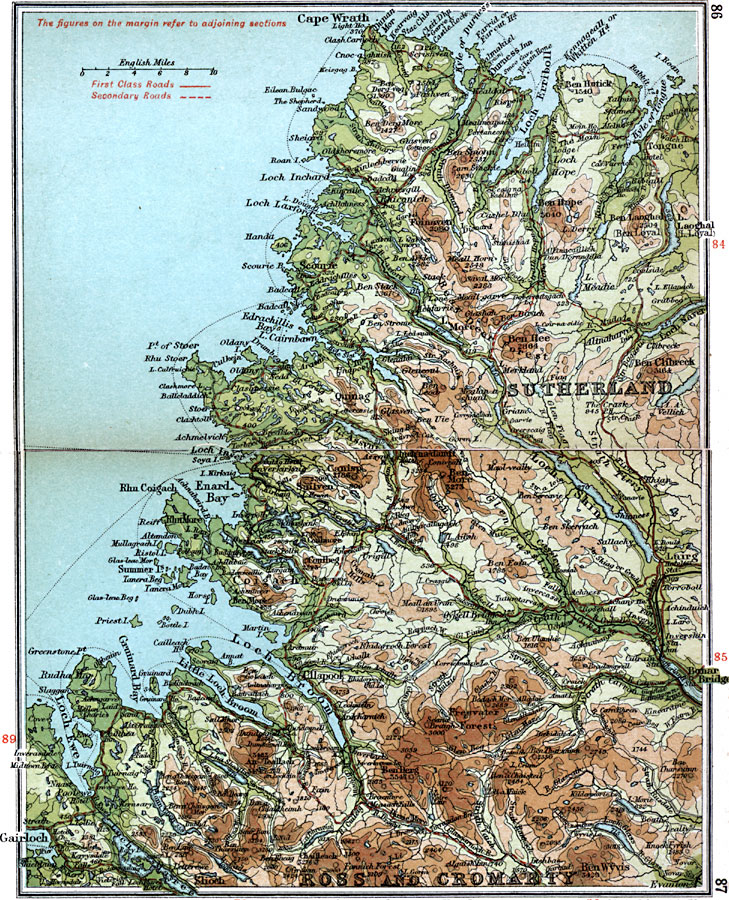
Description: A detailed travel map of northwestern Scotland from 1908, showing portions of Sutherland, Ross and Cromarty counties. The map shows first class and secondary roads, railways, cities, towns, ports, ferry routes, rivers, lakes, terrain and coastal features of the area. This map uses contour–coloring to show terrain, with elevations shown in feet. Cities on this map include Tongue, Lairg, Ullapool, Bonar Bridge, and Gairloch. Rivers and coastal features include River Broom, Strath Dionard, Strath Oykell, Kyle of Tongue, Loch Erriboll, Enard Bay, Loch Shin, Loch Broom, Loch Ewe, and the mountains An Teallach, Ben Derg, Canisp, Ben More, Foinaven, Ben Clibreck, and Ben Wyvis.
Place Names: United Kingdom, Bonar Bridge, �Gairloch, �Lairg, �Ross and Cromarty, �Sutherland, �Wrath,
ISO Topic Categories: inlandWaters,
location,
oceans,
transportation
Keywords: Lairg to Wrath, roads, �transportation, roads, inlandWaters,
location,
oceans,
transportation, Unknown, 1908
Source: J.G. Bartholomew, F.R.G.S., The Handy Touring Atlas of the British Isles Specially Prepared for Cyclists, Motorists, and Travellers (London, United Kingdom : George Newnes, Limited, 1908) 86-87
Map Credit: Courtesy the private collection of Roy Winkelman |
|