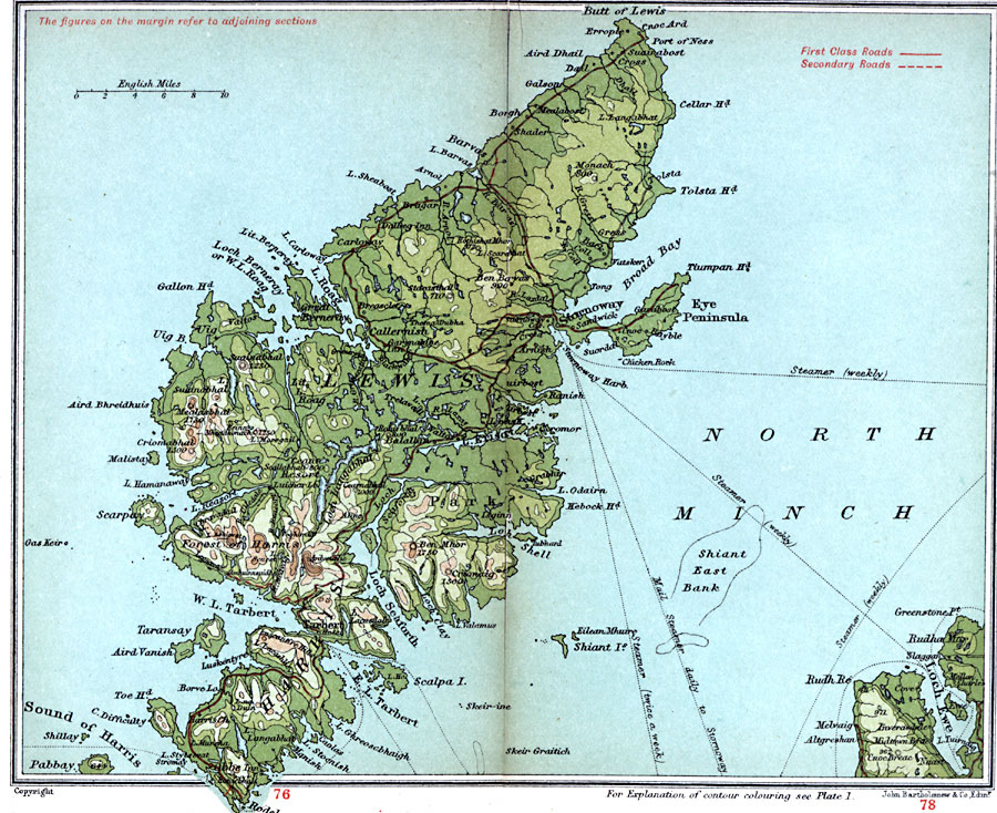
Description: A detailed travel map of the islands Lewis and Harris off the northwestern coast of Scotland from 1908, showing first class and secondary roads, cities, towns, ports, ferry and steamer routes, rivers, lakes, terrain and coastal features of the area. This map uses contour–coloring to show terrain, with elevations shown in feet. Cities and towns on this map include Stornoway, Barvas, Tarbert, and Obbe. Rivers and coastal features include River Arnol, Butt of Lewis, Broad Bay, Eye Peninsula, Loch SeaforthToe Head, Sound of Harris, and the mountains Mealasbhal, Ben Mohr, and the Luscantire Hills.
Place Names: United Kingdom, Harris, �Lewis, �Park,
ISO Topic Categories: inlandWaters,
location,
oceans,
transportation
Keywords: Lewis and Harris, roads, �transportation, roads, inlandWaters,
location,
oceans,
transportation, Unknown, 1908
Source: J.G. Bartholomew, F.R.G.S., The Handy Touring Atlas of the British Isles Specially Prepared for Cyclists, Motorists, and Travellers (London, United Kingdom : George Newnes, Limited, 1908) 88-89
Map Credit: Courtesy the private collection of Roy Winkelman |
|