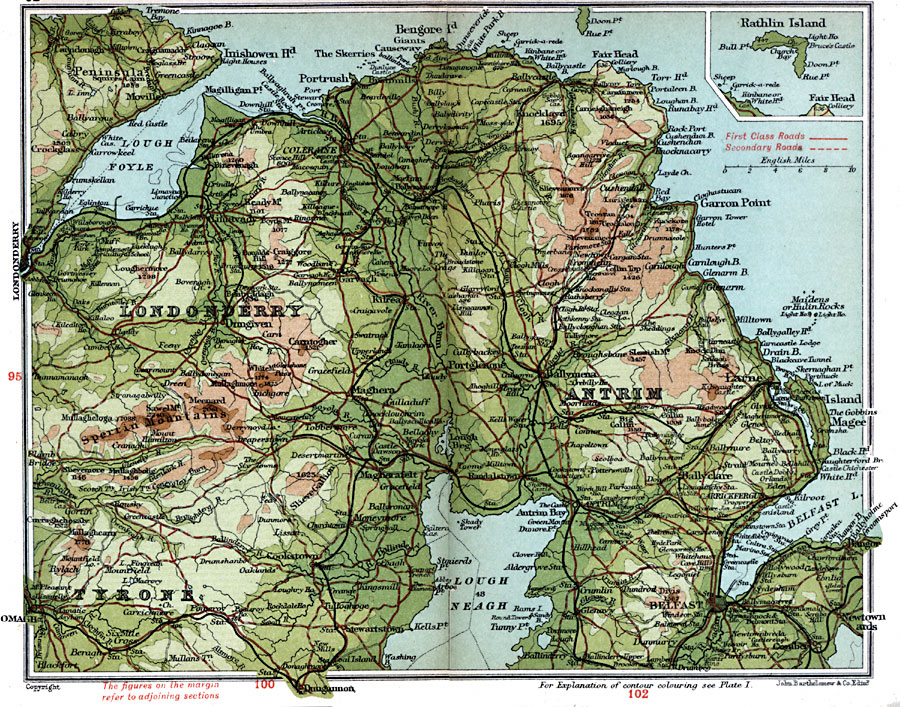
Description: A detailed travel map of Ireland in 1908, showing portions of counties Londonderry, Antrim, and Tyrone. The map shows first class and secondary roads, railways, cities, towns, ports, rivers, terrain, and coastal features of the area. This map uses contour–coloring to show terrain, with elevations shown in feet. Cities on this map include Carndonagh, Coleraine, Ballymena, Dungiven, Larne, Omagh, Belfast, and Dungannon. Lakes and coastal features include Lough Neagh, Lough Foyl, Inishowen Head, Island Magee, and Belfast Lough, and the mountains Divis, Slieveanorra, and the Sperrin Mountains. An inset map shows Rathlin Island.
Place Names: Ireland, Antrim, �Belfast, �Carrickfergus, �Coleraine, �Garron Point, �Larne, �Londonderry, �Tyron
ISO Topic Categories: inlandWaters,
location,
oceans,
transportation
Keywords: Antrim and Londonderry, roads, �transportation, roads, inlandWaters,
location,
oceans,
transportation, Unknown, 1908
Source: J.G. Bartholomew, F.R.G.S., The Handy Touring Atlas of the British Isles Specially Prepared for Cyclists, Motorists, and Travellers (London, United Kingdom : George Newnes, Limited, 1908) 92-93
Map Credit: Courtesy the private collection of Roy Winkelman |
|