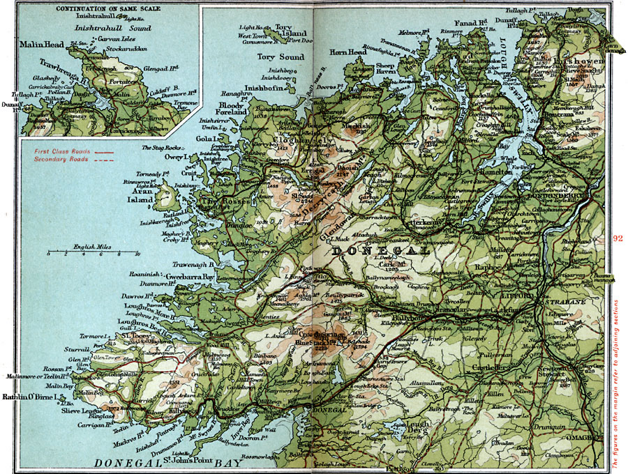
Description: A detailed travel map of Ireland in 1908, showing County Donegal with an inset map of Malin Head. The map shows first class and secondary roads, railways, cities, towns, ports, rivers, lakes, terrain, and coastal features of the area. This map uses contour–coloring to show terrain, with elevations shown in feet. Cities on this map include Omagh, Lifford, Strabane, Londonderry, Inishowen, Letterkenny, Donegal, Cloghaneely, and The Roses, with the coastal Donegal Bay, Aran Island, Bloody Foreland, Tory Island, Lough Swilly, and Fanad Head.
Place Names: Ireland, Cloghan, �Donegal, �Inishtrahull Sound, �Lifford, �Londonderry, �Loughderg, �Omagh, �Stribane,
ISO Topic Categories: inlandWaters,
location,
oceans,
transportation
Keywords: County Donegal, roads, �transportation, roads, inlandWaters,
location,
oceans,
transportation, Unknown, 1908
Source: J.G. Bartholomew, F.R.G.S., The Handy Touring Atlas of the British Isles Specially Prepared for Cyclists, Motorists, and Travellers (London, United Kingdom : George Newnes, Limited, 1908) 94-95
Map Credit: Courtesy the private collection of Roy Winkelman |
|