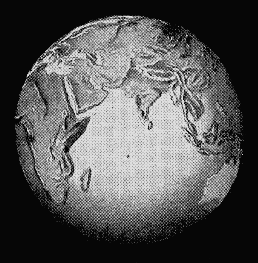
Description: A relief map from 1912 of the globe showing the Eastern Hemisphere, or ‘Old World.’ "The World is round like a ball, and this is the side of the ball called the Old World, the part of the world that was known before Christopher Columbus found America. The rough part of the ball is land, and the smooth part is water. There is much more water on the earth than land." — Mee and Thompson, 1912.
Place Names: Regional Miscellaneous, Africa, �Asia, �Australi
ISO Topic Categories: physical, kRelief, kWorldIndian
Keywords: The Old World, physical, kRelief, physical features, physical, kRelief, kWorldIndian, Unknown, 1912
Source: Arthur Mee and Holland Thompson, Ph.D., The Book of Knowledge Vol 1 (New York, NY: The Grolier Society, 1912) 2
Map Credit: Courtesy the private collection of Roy Winkelman |
|