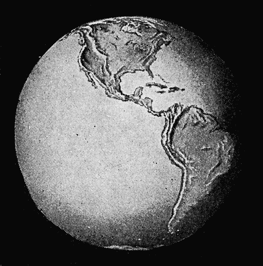
Description: A relief map from 1912 of the globe showing the Western Hemisphere, or ‘New World.’ "The World is round like a ball, [...]. The rough part of the ball is land, and the smooth part is water. There is much more water on the earth than land. This is the other side of the ball, the New World, called America, which the men living in the Old World did not know until Columbus found it, four hundred years ago. America is one of the greatest countries in the world" — Mee and Thompson, 1912.
Place Names: Regional Miscellaneous, North America, �South Americ
ISO Topic Categories: physical, kRelief, kWorldAmericas, kWorldPacific
Keywords: The New World, physical, kRelief, physical features, physical, kRelief, kWorldAmericas, kWorldPacific, Unknown, 1912
Source: Arthur Mee and Holland Thompson, Ph.D., The Book of Knowledge Vol 1 (New York, NY: The Grolier Society, 1912) 4
Map Credit: Courtesy the private collection of Roy Winkelman |
|