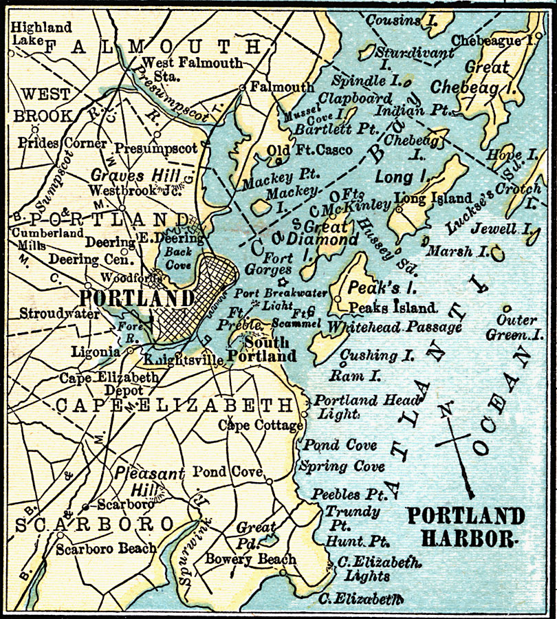
Description: A map from 1920 of the vicinity of Portland, Maine, showing the major streets, railroads, neighboring towns, rivers, and islands in the area from Great Chebeag Island to Cape Elizabeth.
Place Names: Maine, Portland, �Prides Corner, �Graves Hill, �Old Ft. Casco, �Stroudwater, �Deering, �Woodfords, �South Portland, �Scarboro, �Peak's Island, �West Falmout
ISO Topic Categories: inlandWaters,
location,
oceans,
transportation
Keywords: Portland, Maine, physical, �political, �transportation, physical features, roads, inlandWaters,
location,
oceans,
transportation, Unknown, 1920
Source: , Leslie's New World Atlas (New York City, NY: Leslie-Judge Company, 1920) 40
Map Credit: Courtesy the private collection of Roy Winkelman |
|