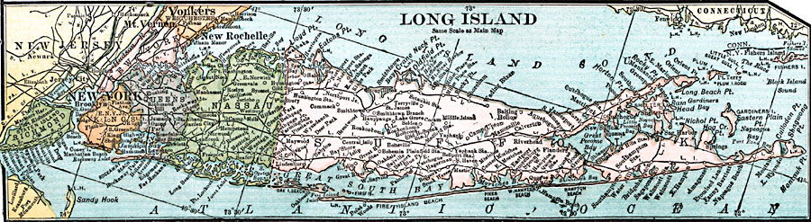
Description: A map from 1920 of Long Island, New York, showing towns, counties and county seats, and railroads.
Place Names: New York, New York, �Jersey City, �Mount Vernon, �Yonkers, �New Rochelle, �Brooklyn, �Nassau, �New York Cit
ISO Topic Categories: boundaries,
inlandWaters,
location,
oceans,
transportation
Keywords: Long Island, New York, physical, �political, �transportation, physical features, major political subdivisions,
county borders, railroads, boundaries,
inlandWaters,
location,
oceans,
transportation, Unknown, 1920
Source: , Leslie's New World Atlas (New York City, NY: Leslie-Judge Company, 1920) 45
Map Credit: Courtesy the private collection of Roy Winkelman |
|