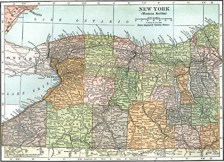
Description: A map from 1914 of the western part of New York showing counties and county seats, principal cities and towns, railroads, canals, lakes, and rivers
Place Names: New York, Buffalo, �Lockport, �Rochester, �Oswego, �Auburn, �Syracuse, �Elmira, �Ithaca, �Jamestow
ISO Topic Categories: boundaries,
inlandWaters,
location,
oceans
Keywords: Western New York, physical, �political, �transportation, physical features, country borders,
major political subdivisions,
county borders, railroads, boundaries,
inlandWaters,
location,
oceans, Unknown, 1914
Source: , Leslie's New World Atlas (New York City, NY: Leslie-Judge Company, 1920) 46
Map Credit: Courtesy the private collection of Roy Winkelman |
|