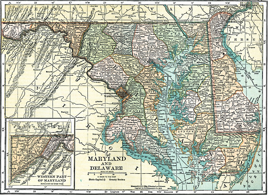
Description: A map from 1920 of Maryland, Delaware, and the District of Columbia, showing State and county boundaries, capitals and county seats, major cities and towns, railroads, canals, the ferry system out of Baltimore, rivers, and coastal features of the Chesapeake Bay, upper Delaware Bay, and lower Potomac River. An inset map shows the western continuation of Maryland.
Place Names: Middle Atlantic States, Hagerstown, �Westminster, �Baltimore, �Havre de Grace, �Annapolis, �Georgetown, �Washington, �Cambridge, �Wilmington, �Dover, �Atlantic States, �Atlantic Ocean, �East Coast, �Maryland, �Delawar
ISO Topic Categories: boundaries,
inlandWaters,
location,
oceans,
transportation
Keywords: Maryland and Delaware, physical, �political, �transportation, physical features, major political subdivisions,
county borders,
local jurisdictions, water routes,
railroads, boundaries,
inlandWaters,
location,
oceans,
transportation, Unknown, 1920
Source: , Leslie's New World Atlas (New York City, NY: Leslie-Judge Company, 1920) 50
Map Credit: Courtesy the private collection of Roy Winkelman |
|