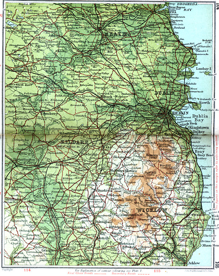
Description: A detailed travel map of Ireland in 1908, showing all or portions of counties Meath, Dublin, Kildare, and Wicklow. The map shows first class and secondary roads, railways, cities, towns, ports, rivers, lakes, terrain, and coastal features of the area. This map uses contour–coloring to show terrain, with elevations shown in feet. Cities on this map include Drogheda, Navan, Athboy, Dublin, Edenderry, Kill, Naas, Kildare, Carlow, Tinahely, Arklow, and Wicklow, with the coastal Drogheda Bay, River Boyne, Lambay Isle, Dublin Bay, and Mizen Head.
Place Names: Ireland, Castledermot, �Donard, �Dublin, �Edenderry, �Kildare, �Meath, �Rathdrum, �Wicklo
ISO Topic Categories: inlandWaters,
location,
oceans,
transportation
Keywords: Dublin and Wicklow, roads, �transportation, roads, inlandWaters,
location,
oceans,
transportation, Unknown, 1908
Source: J.G. Bartholomew, F.R.G.S., The Handy Touring Atlas of the British Isles Specially Prepared for Cyclists, Motorists, and Travellers (London, United Kingdom : George Newnes, Limited, 1908) 104-105
Map Credit: Courtesy the private collection of Roy Winkelman |
|