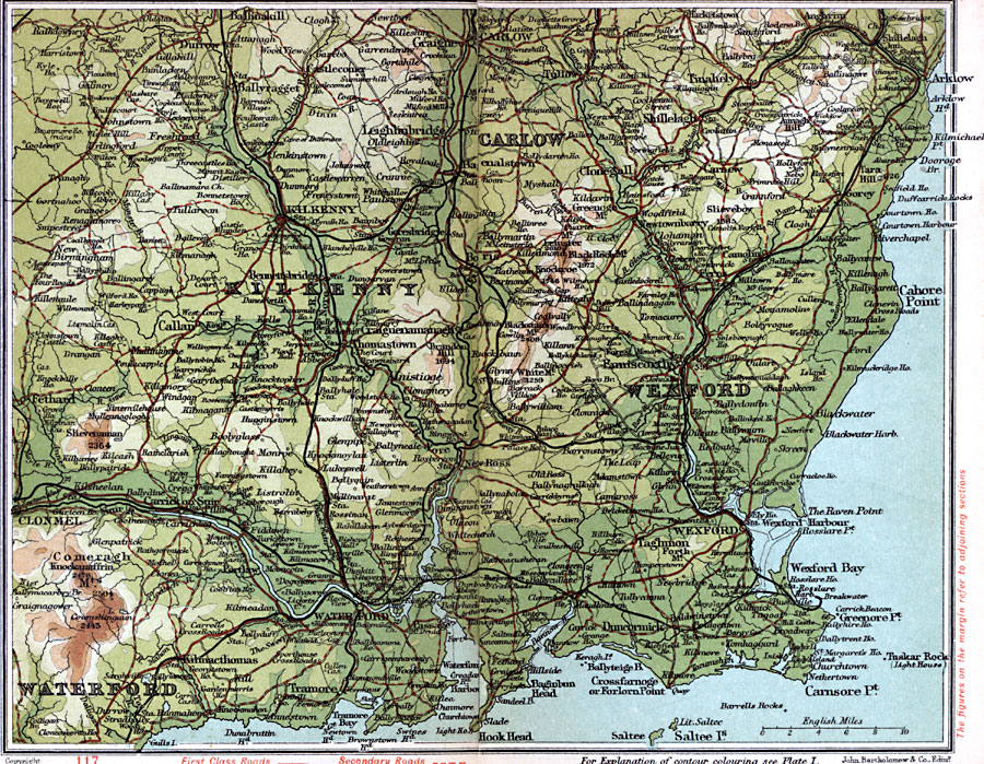
Description: A detailed travel map of Ireland in 1908, showing all or portions of counties Carlow, Kilkenny, Wexford, and Waterford. The map shows first class and secondary roads, railways, cities, towns, ports, rivers, lakes, terrain and coastal features of the area. This map uses contour–coloring to show terrain, with elevations shown in feet. Cities on this map include Ballyraget, Kilkenny, Carlow, Arklow, Enniscorthy, Thomastown, Clonmel, Wexford, Waterford, and Tramore. Mountains and coastal features include Knockanaffrin Mountains, Black Rock Mountain, Slievenaman, Tramore Bay, Waterford Harbor, Carnsore Point, Wexford Bay, and Cahore Point.
Place Names: Ireland, Carlow, �Clonegall, �Clonmel, �Kilkenny, �Taghmon, �Waterford, �Wexfor
ISO Topic Categories: inlandWaters,
location,
oceans,
transportation
Keywords: Wexford and Waterford, roads, �transportation, roads, inlandWaters,
location,
oceans,
transportation, Unknown, 1908
Source: J.G. Bartholomew, F.R.G.S., The Handy Touring Atlas of the British Isles Specially Prepared for Cyclists, Motorists, and Travellers (London, United Kingdom : George Newnes, Limited, 1908) 114-115
Map Credit: Courtesy the private collection of Roy Winkelman |
|