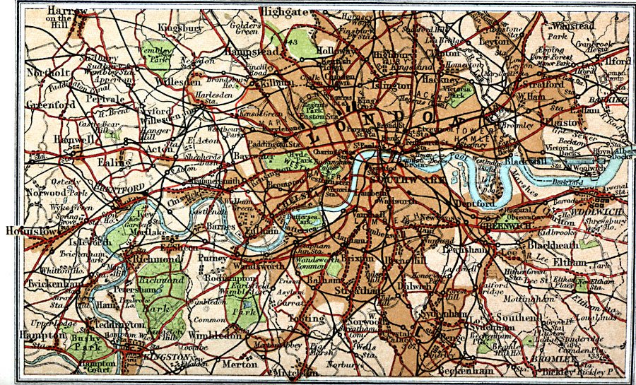
Description: A map of London and vicinity from 1908, showing first class and secondary roads, railways and rail stations, canals, the River Thames, urban areas and suburbs, parks, landmarks, and neighboring cities, towns, and villages.
Place Names: United Kingdom, Brixton, �Chelsea, �Hampstead, �Hampton, �Highgate, �Hounslow, �London, �Wimbledo
ISO Topic Categories: inlandWaters,
location,
oceans,
transportation
Keywords: London and Suburbs, roads, �transportation, roads, inlandWaters,
location,
oceans,
transportation, Unknown, 1908
Source: J.G. Bartholomew, F.R.G.S., The Handy Touring Atlas of the British Isles Specially Prepared for Cyclists, Motorists, and Travellers (London, United Kingdom : George Newnes, Limited, 1908) 120
Map Credit: Courtesy the private collection of Roy Winkelman |
|