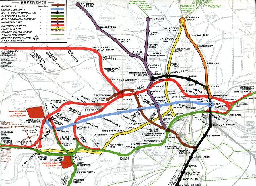
Description: A map of London showing the London County Council Tramway network of electric trams in 1909. The map is color–coded to show the lines and stations for the Bakerloo, Central London, City and South London, District Railway, Great Northern and City, Hampstead, Metropolitan, Piccadilly, and London United Tram lines. The map also shows other tramways, subway connections, other railways, and the Shepherd's Bush and Earl Court Exhibitions.
Place Names: United Kingdom, Alexandra Palace, �Barnet, �Chelsea, �Chiswick, �Edmonton, �Finchley, �Hampstead, �Highgate, �Islington, �Peckham, �Tottenham, �Whetstone, �Winchmore Hill, �Wormwoo
ISO Topic Categories: inlandWaters,
location,
oceans,
transportation
Keywords: Metropolitan Electric Trams, transportation, �railroads, �railroads, inlandWaters,
location,
oceans,
transportation, Unknown, 1909
Source: Ebenezer Ward and George Lock, Guide to London (London, United Kingdom : Ward, Lock & Co. , 1909) 56
Map Credit: Courtesy the private collection of Roy Winkelman |
|