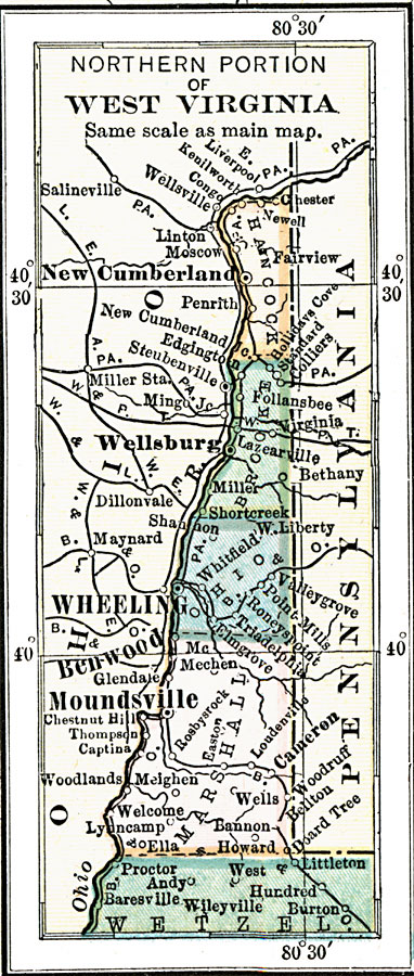
Description: A map from 1910 of the northern part of West Virginia between Ohio and Pennsylvania, showing cities and towns, counties and county seats, railroads, and rivers.
Place Names: West Virginia, New Cumberland, �Wellsburg, �Wheeling, �Benwood, �Moundsville, �Fairview, �Banno
ISO Topic Categories: boundaries,
inlandWaters,
location,
transportation
Keywords: Northern West Virginia, physical, �political, �transportation, physical features, major political subdivisions,
county borders, railroads, boundaries,
inlandWaters,
location,
transportation, Unknown, 1910
Source: , Leslie's New World Atlas (New York City, NY: Leslie-Judge Company, 1920) 52
Map Credit: Courtesy the private collection of Roy Winkelman |
|