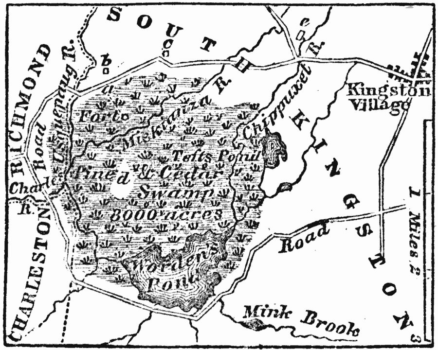
Description: A map of the swampy area in southern Rhode Island where the Wampanoag built their fort, site of a major battle during the King Philip's War or Metacom's War (1675–1676). The swamp is a short distance S.W. from the village of Kingston, in the township of South Kingston, Washington County, Rhode Island.
Place Names: Rhode Island, Kingston, �South Kingsto
ISO Topic Categories: transportation,
biota,
inlandWaters,
location
Keywords: Metacomet's Narragansett Fort and Swamp, political, �physical, �statistical, �transportation, kNativeAmerican, physical features, local jurisdictions, vegetation, roads, transportation,
biota,
inlandWaters,
location, Unknown, 1675
Source: Marcius Willson, History of the United States (New York, NY: Ivison, Blakeman, Taylor, and Co., 1872) 88
Map Credit: Courtesy the private collection of Roy Winkelman |
|