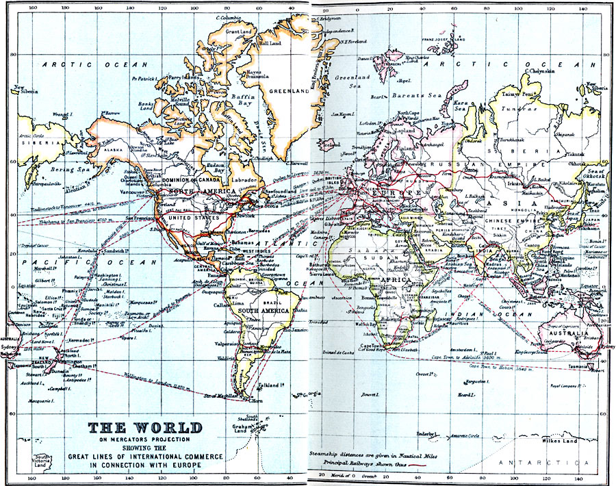
Description: A map of the World from 1910, showing the world's main lines of international commerce in connection with Europe. This map shows principal railways, and steamship routes with distance given in nautical miles between ports.
Place Names: A Complete Map of Globes and Multi-continent, commerce, �Europe, �globe, �worl
ISO Topic Categories: inlandWaters,
location,
oceans
Keywords: The World on Mercator's Projection , physical, �physical features, �transportation, �railroads, �water routes, physical features, railroads,
water routes, inlandWaters,
location,
oceans, Mercator,
Unknown, 1910
Source: J.G. Bartholomew, LLD, A Literary & Historical Atlas of Europe (New York, New York: E.P. Dutton & Co., Ltd. , 1910) 2-3
Map Credit: Courtesy the private collection of Roy Winkelman |
|