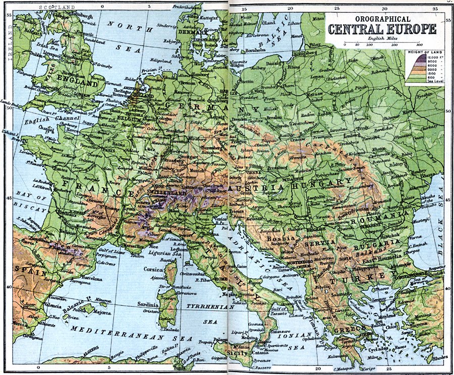
Description: A map from 1910 of Central Europe showing the orographical (elevation) features of the region, including the Alps, Pyrenees, Apennines, Transylvanian Alps, and the Carpathians. The map is color–coded to show areas of elevation between sea level and 12000 feet. Major cities, rivers, and railways are shown.
Place Names: Western and Central Europe, Austria, �France, �Germany, �Greece, �Italy, �Romania, �Spain, �Turkey, �United Kingdo
ISO Topic Categories: inlandWaters,
location,
oceans
Keywords: Orographical Central Europe, physical, �physical features, �orographical, �physical features, inlandWaters,
location,
oceans, Unknown, 1910
Source: J.G. Bartholomew, LLD, A Literary & Historical Atlas of Europe (New York, NY: E.P. Dutton & Co., Ltd. , 1910) 4-5
Map Credit: Courtesy the private collection of Roy Winkelman |
|