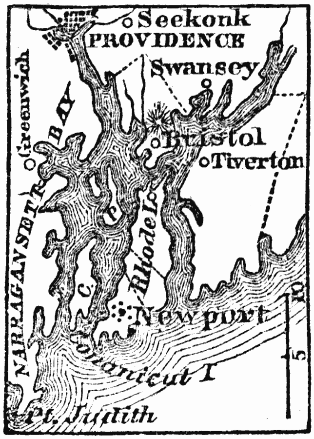
Description: A map from 1872 of Narragansett Bay in the eastern part of the state of Rhode Island in the vicinity of Providence and Newport. Narragansett Bay is twenty–eight miles long from north to south, and from eight to twelve broad.
Place Names: Rhode Island, Bristol, �Providence, �Newpor
ISO Topic Categories: location,
oceans,
inlandWaters
Keywords: Narragansett Bay, physical, physical features, location,
oceans,
inlandWaters, Unknown, 1872
Source: Marcius Willson, History of the United States (New York, NY: Ivison, Blakeman, Taylor, and Co., 1872) 112
Map Credit: Courtesy the private collection of Roy Winkelman |
|