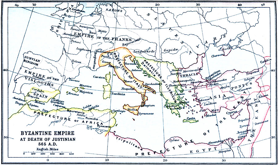
Description: A map of Europe, Western Asia, North Africa, and the Mediterranean region showing the Byzantine Empire at the death of Justinian I in AD 565. The map id color–coded to show the Roman Prefecture of the East (Byzantine), and the prefectures of the west, including the Prefecture of Italy, Prefecture of Illyricum, and the Prefecture of Africa and Spain. The Prefecture of the East is subdivided into Thracia, Asia, Goth and Colchis on the Black Sea, Pontus, The East (Syria and Palestine), Egypt, and Tripolitana in North Africa. The map also shows the territories of Britannia in France and Britain, the Empire of the Franks, the Empire of the Visigoths, the Suevian Kingdom, and the territories of the Saxons, Slaves, Longobards, and Avars.
Place Names: Regional Mediterranean, Africa, �Asia, �Europ
ISO Topic Categories: country borders, �political, kRomanEmpire, kWorldMedSea, kWorldAfroAsia, kWorldEurasia, kWorldEuroAfrica
Keywords: Byzantine Empire at Death of Justinian, country borders, �political, kRomanEmpire, country borders, country borders, �political, kRomanEmpire, kWorldMedSea, kWorldAfroAsia, kWorldEurasia, kWorldEuroAfrica, Unknown, AD 565
Source: J.G. Bartholomew, LLD, A Literary & Historical Atlas of Europe (New York, New York: E.P. Dutton & Co., Ltd. , 1910) 13
Map Credit: Courtesy the private collection of Roy Winkelman |
|