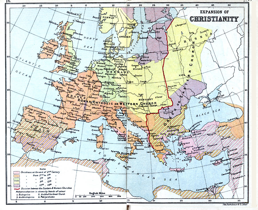
Description: A map of Europe showing the expansion of Christianity from the end of the 2nd Century A.D. through the 14th Century. This map is color–coded to show the extent and expansion of Christianity throughout this period in solid colors, with the corresponding spread of Mohammedanism in Europe, North Africa, and the Near East in banded colors. A line separating the Roman Catholic, or Western Church, and Greek, or Eastern Church is shown, as well as symbols indicating Bishoprics, Archbishoprics, Archbishoprics of the Greek Church, and Patriarchates.
Place Names: Western and Central Europe, France, �Germany, �Greece, �Ireland, �Italy, �Romania, �Russia, �Spain, �Sweden, �United Kingdo
ISO Topic Categories: inlandWaters,
location,
oceans
Keywords: Expansion of Christianity, country borders, �political, country borders, inlandWaters,
location,
oceans, Unknown, 1st Century.–14th Century A.D.
Source: J.G. Bartholomew, LLD, A Literary & Historical Atlas of Europe (New York, NY: E.P. Dutton & Co., Ltd. , 1910) 16-17
Map Credit: Courtesy the private collection of Roy Winkelman |
|