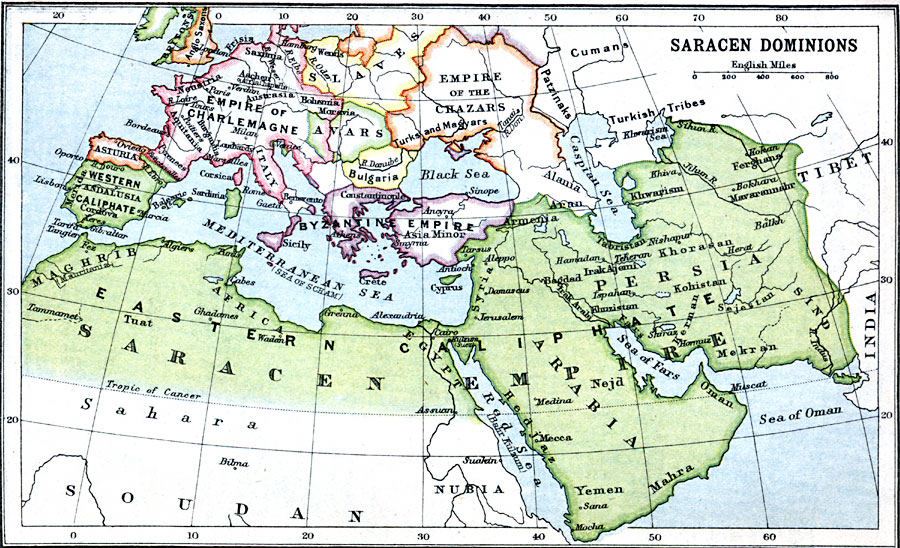
Description: A map showing the Saracen Dominions at its greatest extent from its expansion under the Prophet Muhammad in 622 to the realms of the Umayyad Caliphate (including southern Spain and Portugal, Sardinia, Cyprus, and the Balearic Isles) in 750–1492, with its proximity and influence on Europe. This map also shows the Byzantine Empire, Asturia in northern Spain, the Empire of Charlemagne, the Empire of the Chazars, and the territories of the Avars and Slaves.
Place Names: Regional Miscellaneous, Africa, �Andalusia, �Arabia, �Asia, �Bulgaria, �Greece, �Italy, �Nubia, �Persia, �Suda
ISO Topic Categories: country borders, �political, kWorldMedSea, kWorldAfroAsia, kWorldEurasia, kWorldEuroAfrica
Keywords: Saracen Dominions, country borders, �political, country borders, country borders, �political, kWorldMedSea, kWorldAfroAsia, kWorldEurasia, kWorldEuroAfrica, Unknown, 622–1492
Source: J.G. Bartholomew, LLD, A Literary & Historical Atlas of Europe (New York, NY: E.P. Dutton & Co., Ltd. , 1910) 18
Map Credit: Courtesy the private collection of Roy Winkelman |
|