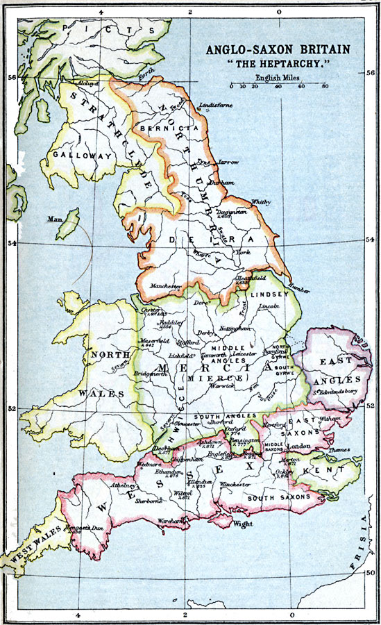
Description: A map of Anglo–Saxon Britain after the departure of the Roman Legion during a period known as the Heptarchy, or Seven Kingdoms (AD 500–850). The map is color–coded to show the territories of Strathclyde, Northumbria, Mercia, East Angles, Kent, Wessex, North Wales, West Wales, and the southern portion of the Picts. Within these divisions are shown the territories of Galloway, Bernicia, Deira, Middle Angles, South Angles, East Saxons, and South Saxons. Important cities, ports, and rivers are shown, as well as historical battle sites with dates.
Place Names: United Kingdom, Kent, �Mercia, �Northumbria, �Strathclyde, �Wales, �Wesse
ISO Topic Categories: inlandWaters,
location,
oceans
Keywords: Anglo-Saxon Britain "The Heptarchy", country borders, �political, country borders, inlandWaters,
location,
oceans, Unknown, A.D. 500–850
Source: J.G. Bartholomew, LLD, A Literary & Historical Atlas of Europe (New York, New York: E.P. Dutton & Co., Ltd. , 1910) 23
Map Credit: Courtesy the private collection of Roy Winkelman |
|