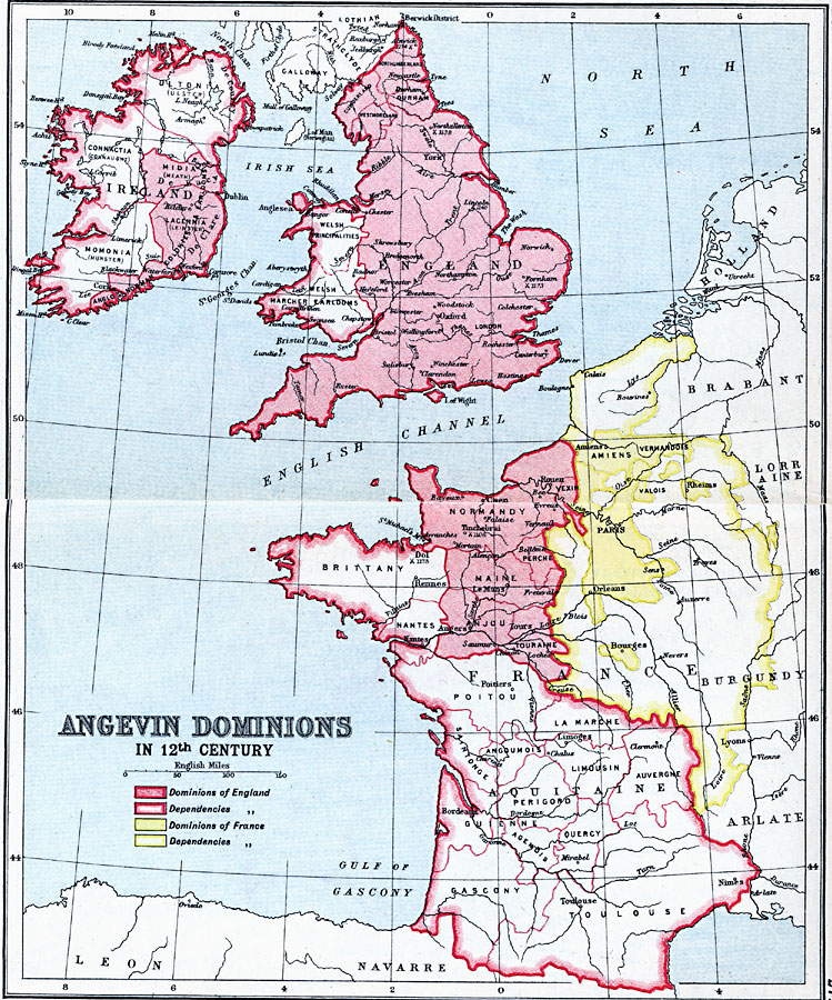
Description: A map showing the possessions of England and France and the dominions dependent on England and France in the 12th Century, after the Norman Conquest and during the Angevin Empire of Henry II and the House of Plantagenet.
Place Names: Western Europe, England, �France, �Ireland, �United Kingdo
ISO Topic Categories: inlandWaters,
location,
oceans
Keywords: Angevin Dominions, country borders, �political, country borders, inlandWaters,
location,
oceans, Unknown, 1154 to 1485
Source: J.G. Bartholomew, LLD, A Literary & Historical Atlas of Europe (New York, NY: E.P. Dutton & Co., Ltd. , 1910) 26-27
Map Credit: Courtesy the private collection of Roy Winkelman |
|