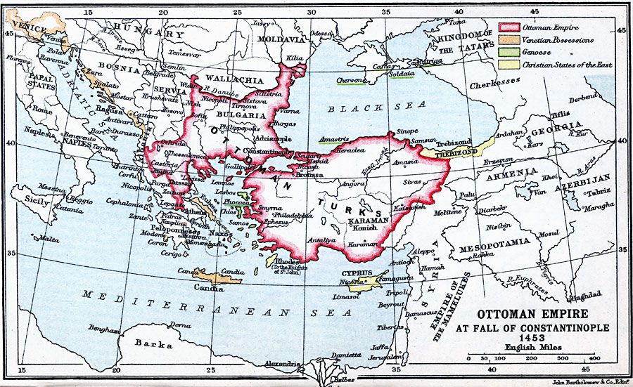
Description: A map of the Ottoman Empire at the time of the fall of Constantinople in 1453, and is color–coded to show the possessions of the Ottoman Empire in Europe and Asia Minor, Venetian possessions, Genoese possessions, and the Christian States of the East. The map also shows portions of the Empire of the Mamelukes, major rivers and bodies of water, and important cities and ports of the time.
Place Names: Regional Mediterranean, Bosnia, �Bulgaria, �Christian States, �Cypress, �Genoa, �Greece, �Ottoman Empire, �Servia, �Turkey, �Venice
ISO Topic Categories: country borders, �political, kEuropeanOttomanEmpire, kWorldMedSea, kWorldEurasia
Keywords: Ottoman Empire at Fall of Constantinople, country borders, �political, kEuropeanOttomanEmpire, country borders, country borders, �political, kEuropeanOttomanEmpire, kWorldMedSea, kWorldEurasia, Unknown, 1453
Source: J.G. Bartholomew, LLD, A Literary & Historical Atlas of Europe (New York, NY: E.P. Dutton & Co., Ltd. , 1910) 28
Map Credit: Courtesy the private collection of Roy Winkelman |
|