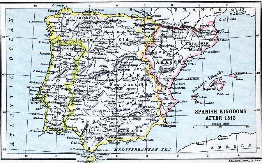
Description: A map of the Spanish Kingdoms after 1513, when Navarre was annexed to Castile. This map shows the territories of Aragon and the Balearic Islands, Castile (and Navarre), and Portugal, as well as the provinces of each, major cities, rivers, coastline, and terrain of the Iberian Peninsula.
Place Names: Spain, Aragon, �Barcelona, �Cadiz, �Castile, �Catalonia, �Granada, �Madrid, �Portuga
ISO Topic Categories: inlandWaters,
location,
oceans
Keywords: Spanish Kingdoms, country borders, �political, country borders, inlandWaters,
location,
oceans, Unknown, 1513
Source: J.G. Bartholomew, LLD, A Literary & Historical Atlas of Europe (New York, New York : E.P. Dutton & Co., Ltd. , 1910) 29
Map Credit: Courtesy the private collection of Roy Winkelman |
|