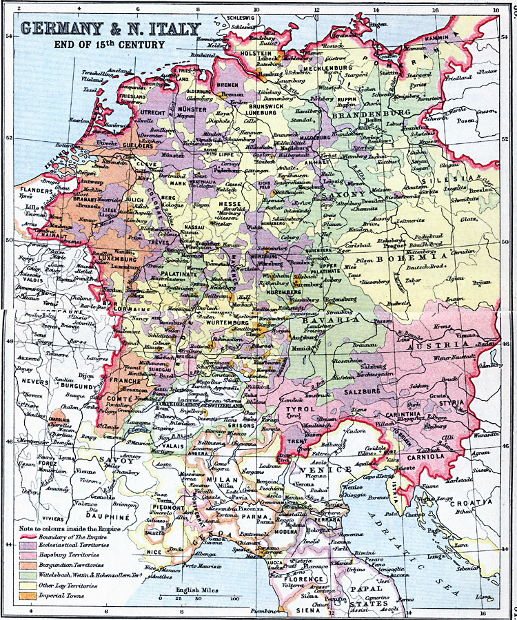
Description: A map detailing the various territories within Germany and northern Italy at the end of the 15th Century. This map highlights the German Empire at the time, and the numerous territories within the Empire and northern Italy, including the Ecclesiastical, Habsburg, Burgundian, Wittelsbach, Wettin, and Hohenzollern territories, Imperial towns, and other "Lay" territories.
Place Names: Western and Central Europe, Austria, �Bavaria, �Bohemia, �Brandenburg, �Germany, �Italy, �Luxemburg, �Saxony, �Wurtembur
ISO Topic Categories: inlandWaters,
location,
oceans
Keywords: Germany and Northern Italy, country borders, �political, kThirtyYearsWar, country borders, inlandWaters,
location,
oceans, Unknown, Late 15th Century
Source: J.G. Bartholomew, LLD, A Literary & Historical Atlas of Europe (New York, NY: E.P. Dutton & Co., Ltd. , 1910) 30-31
Map Credit: Courtesy the private collection of Roy Winkelman |
|