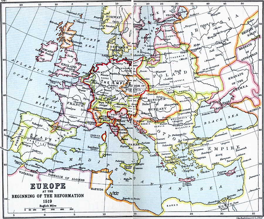
Description: A map of Europe at the time of the Protestant Reformation. This map shows the countries and territories of the Holy Roman Empire, including Brabant, Holland, Holstein, Pomerania, Brunswick, Brandenburg, Hesse, Saxony, Kingdom of Bohemia, Luxemburg, Hainault, Lorraine, Sundgau, French Comte, Swiss Confederation, Breisgau, Bavaria, Austria, Styria, Tyrol, Savoy, Duchy of Milan, Genoa, Modena, Corsica, and Tuscany. This map also shows Denmark-Norway, England, Scotland, Ireland, the southern portion of Sweden, Esthonia, Livonia, Courland, portions of Russia, the Teutonic Order of Konigsberg, Lithuania, Poland, Kingdom of Hungary, Dalmatia, Venice, Papal States, Naples, Flanders, France, Charolles, Avignon, Navarre, Spain, and Portugal. The Tatar territories of Khanate of Kazan, Khanate of Astrakhan, Khanate of Crimea, and Georgia are shown, as well as portions of the Ottoman Empire from Moldavia to Barka in North Africa, Spanish Tripoli, and the African territories of the Hafsids, Pashalik of Algiers, and Watasids. Major rivers and important cities of the time are shown.
Place Names: Western and Central Europe, Holy Roman Empire, Brabant, Holland, Holstein, Pomerania, Brunswick, Brandenburg, Hesse, Saxony, Kingdom of Bohemia, Luxemburg, Hainault, Lorraine, Sundgau, French Comte, Swiss Confederation, Breisgau, Bavaria, Austria, Styria, Tyrol, Savoy, Duchy of Milan, Genoa, Modena, Corsica, Tuscany, Denmark-Norway, England, Scotland, Ireland, Sweden, Esthonia, Livonia, Courland, Russia, Teutonic Order of Konigsberg, Lithuania, Poland, Kingdom of Hungary, Dalmatia, Venice, Papal States, Naples, Flanders, France, Charolles, Avignon, Navarre, Spain, Portugal, Khanate of Kazan, Khanate of Astrakhan, Khanate of Crimea, Georgia Ottoman Empire, Moldavia, Barka, Spanish Tripoli, Hafsids, Pashalik of Algiers, Watasids
ISO Topic Categories: inlandWaters,
location,
oceans
Keywords: Europe at the Beginning of the Reformation, country borders, �political, country borders, inlandWaters,
location,
oceans, Unknown, 1519
Source: J.G. Bartholomew, LLD, A Literary & Historical Atlas of Europe (New York, NY: E.P. Dutton & Co., Ltd. , 1910) 32-33
Map Credit: Courtesy the private collection of Roy Winkelman |
|