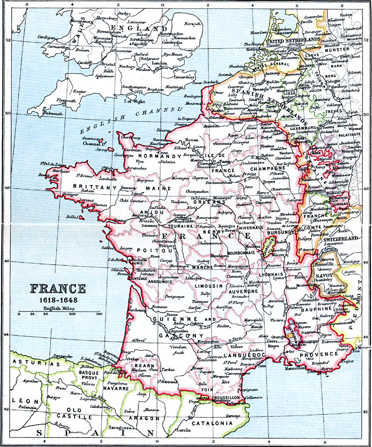
Description: A map of France during the Thirty Years War (1618–1648), showing territorial boundaries, major cities, rivers, and terrain. This map is color–coded to show the territories and Departments of France, and the territories of United Netherlands (including the States General), Spanish Netherlands, portions of the Holy Roman Empire, Switzerland, Savoy, portions of Piedmont, Andorra, and the Spanish territories of Asturias, Leon, Basque Provinces, Navarre, and portions of Old Castile, Aragon, and Catalonia. The map also shows the territories of Charolais (associated with Franche Comté under Habsburg rule), Comtat Venaissin, and the Principality of Orange.
Place Names: France, Anjou, �Auvergne, �Brittany, �Burgundy, �Champagne, �Dauphine, �Languedoc, �Maine, �Normandy, �Orleans,
ISO Topic Categories: inlandWaters,
location,
oceans
Keywords: France, country borders, �political, kThirtyYearsWar, country borders, inlandWaters,
location,
oceans, Unknown, 1618–1648
Source: J.G. Bartholomew, LLD, A Literary & Historical Atlas of Europe (New York, New York: E.P. Dutton & Co., Ltd. , 1910) 34-35
Map Credit: Courtesy the private collection of Roy Winkelman |
|