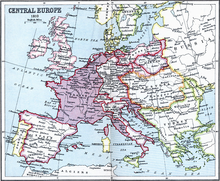
Description: A map of Central Europe in 1810 during the Napoleonic Wars showing the borders of France, the Confederation of the Rhine, Denmark and Norway, Pomerania, Prussia, Warsaw, Austria–Hungary, the Turkish territories of Bosnia, Servia, Wallachia, Albania, and Rumelia, the Illyrian Provinces, Italy–Naples, Sicily, Sardinia, Spain, Portugal, the British isles, and portions of Sweden and Russia.
Place Names: Western and Central Europe, Denmark, �France, �Hungary, �Ireland, �Italy, �Norway, �Poland, �Portugal, �Russia, �Spain, �Sweden, �Switzerlan
ISO Topic Categories: inlandWaters,
location,
oceans
Keywords: Central Europe, country borders, �political, kNapoleonBonaparte, kNapoleonicWars, country borders, inlandWaters,
location,
oceans, Unknown, 1810
Source: J.G. Bartholomew, LLD, A Literary & Historical Atlas of Europe (New York, NY: E.P. Dutton & Co., Ltd. , 1910) 42-43
Map Credit: Courtesy the private collection of Roy Winkelman |
|