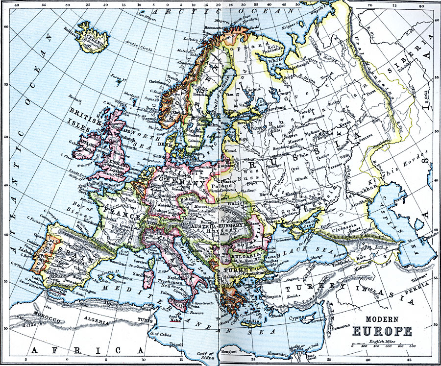
Description: A map of Europe, as it was in 1910, showing country borders, major rivers, cities, and historic battle sites.
Place Names: A Complete Map of Europe, Austria, �Bulgaria, �England, �France, �Germany, �Greece, �Hungary, �Italy, �Poland, �Portugal, �Romania, �Spain, �Sweden, �Switzerland, �Turkey, �United Kingdo
ISO Topic Categories: inlandWaters,
location,
oceans
Keywords: Modern Europe, country borders, �political, country borders, inlandWaters,
location,
oceans, Unknown, 1910
Source: J.G. Bartholomew, LLD, A Literary & Historical Atlas of Europe (New York, New York: E.P. Dutton & Co., Ltd. , 1910) 46-47
Map Credit: Courtesy the private collection of Roy Winkelman |
|