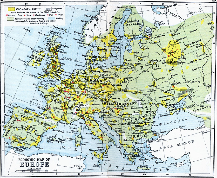
Description: A map showing the chief industries and industrial districts, coal fields, agricultural and fishing districts, major cities, navigable rivers and principal railways throughout Europe in 1910. Chief industries are indicated by letter, with (C) for cotton, (I) for iron, (L) for linen, (M) for machinery, (S) for silk, and (W) for wool. Wine production areas are also shown.
Place Names: A Complete Map of Europe, Austria, �Bulgaria, �England, �France, �Germany, �Greece, �Hungary, �Italy, �Poland, �Portugal, �Romania, �Spain, �Sweden, �Switzerland, �Turkey, �United Kingdo
ISO Topic Categories: inlandWaters,
location,
oceans,
transportation
Keywords: Economic Map of Europe, country borders, �political, �transportation, �railroads, �water routes, kEconomic, kResources, country borders, railroads,
water routes, inlandWaters,
location,
oceans,
transportation, Unknown, 1910
Source: J.G. Bartholomew, LLD, A Literary & Historical Atlas of Europe (New York, New York: E.P. Dutton & Co., Ltd. , 1910) 48-49
Map Credit: Courtesy the private collection of Roy Winkelman |
|