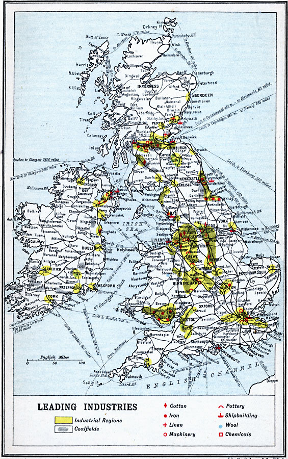
Description: A map of the British Isles from 1910 showing the industrial districts. This map is color–coded to show the industrial districts and coalfields, and uses symbols to indicate areas of predominant cotton, iron, linen, machinery, pottery, shipbuilding, wool, and chemical industries. Steamship routes are shown, along with distances between major ports indicated in miles. Major cities, ports, trade centers, and railways are also shown.
Place Names: United Kingdom, Bristol, �Dundee, �Edinborough, �Falmouth, �Glasgow, �London, �Londonderry, �Manchester, �Newcastle, �Plymout
ISO Topic Categories: inlandWaters,
location,
oceans
Keywords: British Isles Economic - Leading Industries, physical, �physical features, �topographical, �statistical, �industry, kIndustry, topographical,
physical features, industry, inlandWaters,
location,
oceans, Unknown, 1910
Source: J.G. Bartholomew, LLD, A Literary & Historical Atlas of Europe (New York, New York: E.P. Dutton & Co., Ltd. , 1910) 53
Map Credit: Courtesy the private collection of Roy Winkelman |
|