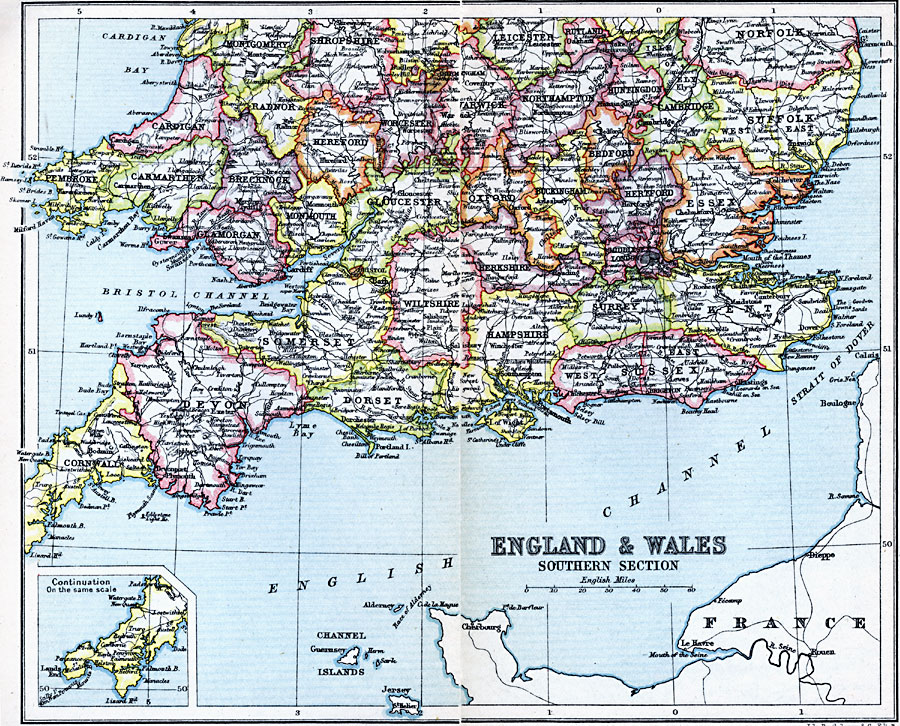
Description: A map of the southern sections of England and Wales in 1910. This map is color–coded to show the counties of the region, and shows major cities and towns, railways, rivers, and terrain.
Place Names: United Kingdom, Bedford, �Cambridge, �Cornwall, �Devon, �Dorset, �Essex, �Hampshire, �Huntington, �Kent, �London, �Montgomery, �Oxford, �Somerse
ISO Topic Categories: inlandWaters,
location,
oceans
Keywords: England and Wales - Southern Section, physical, �physical features, �topographical, �topographical,
physical features, inlandWaters,
location,
oceans, Unknown, 1910
Source: J.G. Bartholomew, LLD, A Literary & Historical Atlas of Europe (New York, New York: E.P. Dutton & Co., Ltd. , 1910) 56-57
Map Credit: Courtesy the private collection of Roy Winkelman |
|