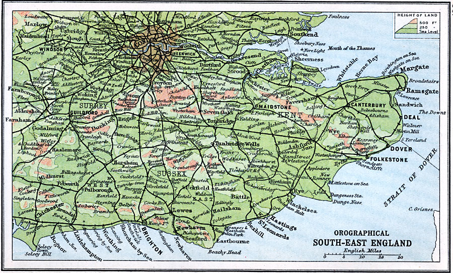
Description: An orographical map of southeastern England in 1910, showing color–contouring elevations from sea level to above 500 feet. This map shows railroads, canals, rivers, terrain, and major cities and towns, including London, Windsor, Southend, Gravesend, Guilford, Maidstone, Canterbury, Dover, Folkestone, Hastings, Brighton, Chichester, and Tunbridge Wells.
Place Names: United Kingdom, Brighton, �Canterbury, �Deal, �Dover, �Maidstone, �Windso
ISO Topic Categories: inlandWaters,
location,
oceans,
elevation
Keywords: Orographical South-East England, physical, �physical features, �topographical, �topographical,
physical features, inlandWaters,
location,
oceans,
elevation, Unknown, 1910
Source: J.G. Bartholomew, LLD, A Literary & Historical Atlas of Europe (New York, New York: E.P. Dutton & Co., Ltd. , 1910) 60
Map Credit: Courtesy the private collection of Roy Winkelman |
|