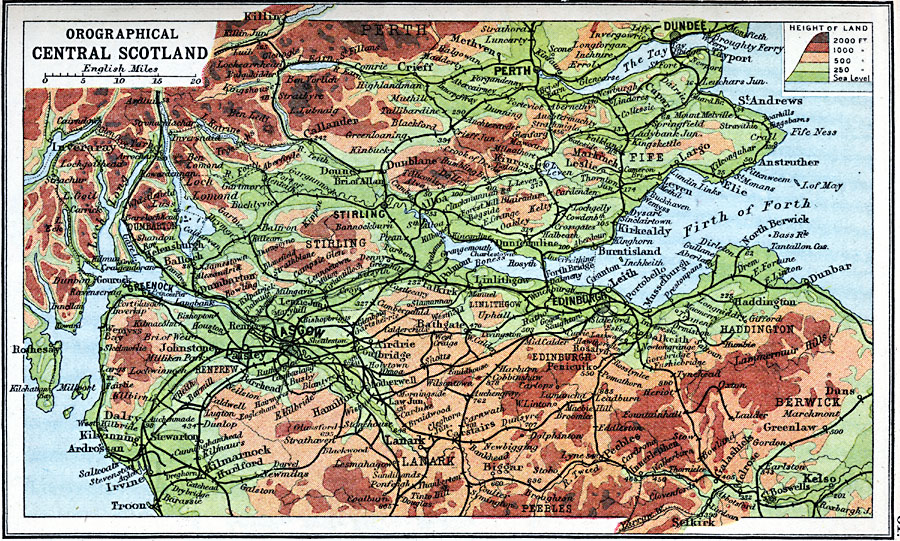
Description: A map of Central Scotland in 1910, showing the orographical (elevation) features of the region, including the Lammermuir Hills, and the Highlands around Ben Lomond and Ben Vorlich. The map is color–coded to show areas of elevation between sea level and 2000 feet. Major cities, railways, rivers, and coastal features are shown.
Place Names: United Kingdom, Dundee, �Edinborough, �Glasgow, �Perth, �Scotland, �Stirlin
ISO Topic Categories: inlandWaters,
location,
oceans,
elevation
Keywords: Orographical Central Scotland, physical, �physical features, �topographical, �topographical,
physical features, inlandWaters,
location,
oceans,
elevation, Unknown, 1910
Source: J.G. Bartholomew, LLD, A Literary & Historical Atlas of Europe (New York, New York: E.P. Dutton & Co., Ltd. , 1910) 61
Map Credit: Courtesy the private collection of Roy Winkelman |
|