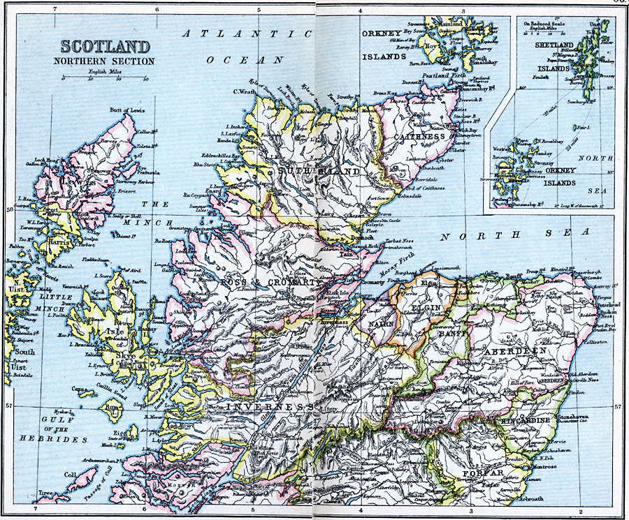
Description: A map of the northern portion of Scotland in 1910, showing major cities and towns, railways and ferry routes, rivers, mountains, and coastal features, with an inset map of the Shetland and Orkney islands. This map shows the counties of Caithness, Sutherland, Ross and Cromarty, Aberdeen, Banff, Elgin, Nairn, Inverness, Kincardine, Forfar, and the islands of Skye and the Hebrides.
Place Names: United Kingdom, Aberdeen, �Banff, �Inverness, �Isle of Skye, �Nairn, �Orkney Islands, �Ross & Cromarty, �Scotland, �Shetland Islands, �Sutherlan
ISO Topic Categories: inlandWaters,
location,
oceans
Keywords: Scotland Northern Section, physical, �physical features, �topographical, �political, �country borders, topographical,
physical features, country borders, inlandWaters,
location,
oceans, Unknown, 1910
Source: J.G. Bartholomew, LLD, A Literary & Historical Atlas of Europe (New York, New York: E.P. Dutton & Co., Ltd. , 1910) 62-63
Map Credit: Courtesy the private collection of Roy Winkelman |
|