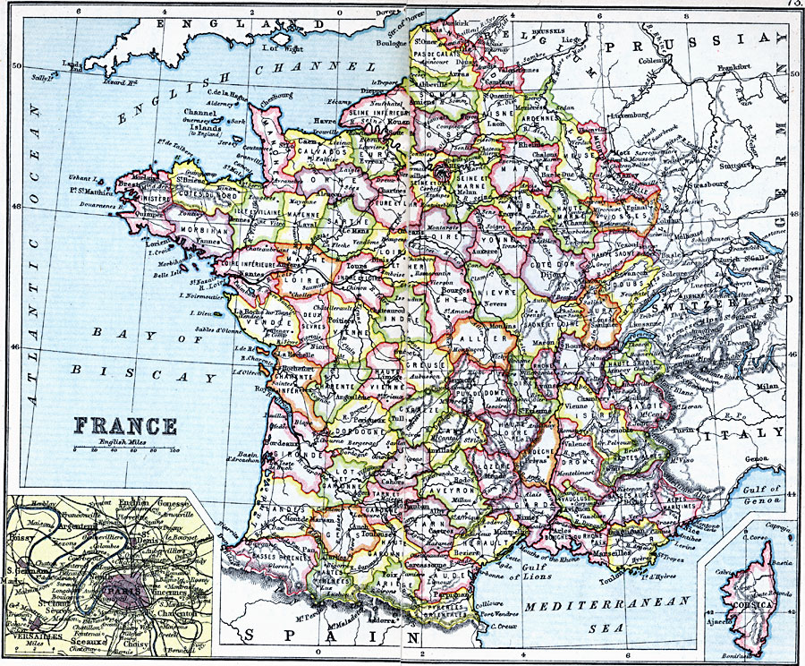
Description: A map of France in 1910, showing major cities and towns, rivers, and railroads. This map is color–coded to show the administrative Departments of France with their capitals. Two inset maps detail the environs of Paris and the French controlled island of Corsica.
Place Names: France, Bordeaux, �Dunkerque, �Grenoble, �Lyon, �Nancy, �Nice, �Orleans, �Paris, �Starsbourg, �Tour
ISO Topic Categories: inlandWaters,
location,
oceans
Keywords: France, physical, �physical features, �topographical, �political, �country borders, topographical,
physical features, country borders, railroads, inlandWaters,
location,
oceans, Unknown, 1910
Source: J.G. Bartholomew, LLD, A Literary & Historical Atlas of Europe (New York, New York: E.P. Dutton & Co., Ltd. , 1910) 72-73
Map Credit: Courtesy the private collection of Roy Winkelman |
|