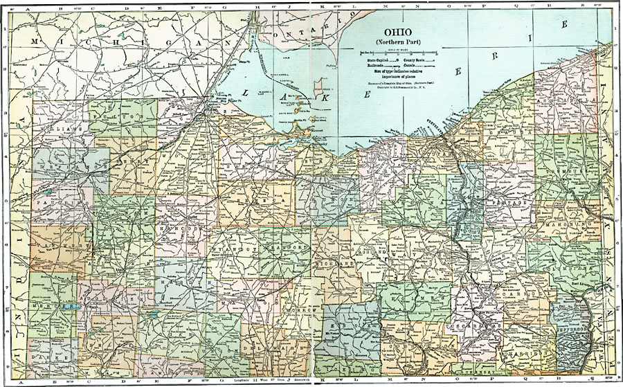
Description: A map from 1920 of the northern part of Ohio, showing principal cities and towns, counties and county seats, railroads, canals, rivers, and islands of Lake Erie.
Place Names: Ohio, Toledo, �Hicksville, �Fremont, �Bellevue, �Sandusky, �Lorain, �Cleveland, �Akron, �Youngstown, �East Liverpool, �Findlay, �Lima, �Marion, �Mansfield, �Canto
ISO Topic Categories: boundaries,
inlandWaters,
location,
transportation
Keywords: Northern Ohio, physical, �political, �transportation, physical features, country borders,
major political subdivisions,
county borders, roads,
railroads,
water routes, boundaries,
inlandWaters,
location,
transportation, Unknown, 1920
Source: , Leslie's New World Atlas (New York City, NY: Leslie-Judge Company, 1920) 60-61
Map Credit: Courtesy the private collection of Roy Winkelman |
|