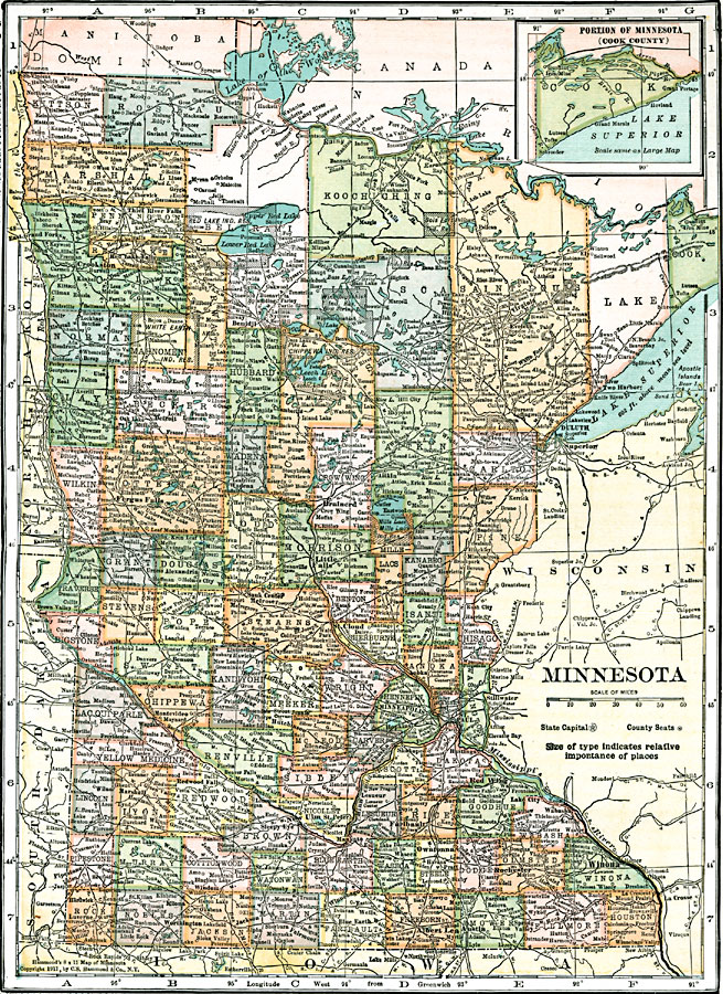
Description: A map from 1911 of Minnesota showing the capital of St. Paul, counties and county seats, major cities and towns, Indian reservations, railroads, lakes, and rivers, including the headwaters of the Mississippi River.
Place Names: Minnesota, Crookston, �Hibbing, �Duluth, �Superior, �Fergus Falls, �Brainerd, �Sauk Center, �Melrose, �St. Cloud, �Hutchinson, �Minneapolis, �Hopkins, �Hastings, �Red Wing, �Lake City, �Winona, �Redwood Falls, �New Ulm, �Albert Lea, �Austi
ISO Topic Categories: boundaries,
inlandWaters,
location,
transportation
Keywords: Minnesota, physical, �political, �transportation, kNativeAmerican, physical features, major political subdivisions,
county borders,
country borders, roads,
railroads, boundaries,
inlandWaters,
location,
transportation, Unknown, 1911
Source: , Leslie's New World Atlas (New York City, NY: Leslie-Judge Company, 1920) 72
Map Credit: Courtesy the private collection of Roy Winkelman |
|