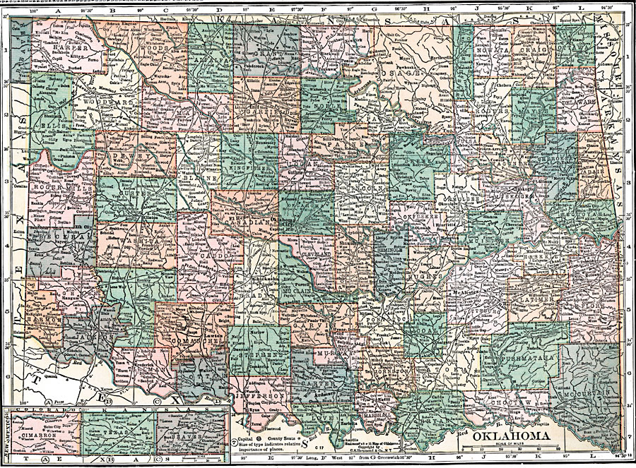
Description: A map from 1920 of Oklahoma showing the capital of Oklahoma City, counties and county seats, principal cities and towns, railroads, and rivers.
Place Names: Oklahoma, Woodward, �Elk City, �Sayre, �Frederick, �Hobart, �Butte, �Alva, �Lawton, �Ryan, �Chickasha, �Capitol Hill, �Oklahoma City, �El Reno, �Guthrie, �Purcell, �Lindsay, �Ponca City, �Pauls Valley, �Ardmere, �Marietta, �Madill, �Cleveland, �Okemah, �Durant,
ISO Topic Categories: boundaries,
inlandWaters,
location,
transportation
Keywords: Oklahoma, physical, �political, �transportation, physical features, major political subdivisions,
county borders, roads,
railroads, boundaries,
inlandWaters,
location,
transportation, Unknown, 1920
Source: , Leslie's New World Atlas (New York City, NY: Leslie-Judge Company, 1920) 82
Map Credit: Courtesy the private collection of Roy Winkelman |
|