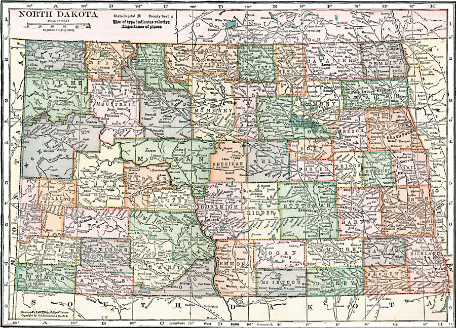
Description: A map from 1920 of North Dakota, showing the capital of Bismarck, counties and county seats, principal cities and towns, railroads, mountains, lakes, and rivers.
Place Names: North Dakota, Williston, �Dickinson, �Mandan, �Minot, �Willow City, �Bismarck, �Cando, �Jamestown, �Kulm, �Valley City, �Devils Lake, �Langdon, �Park River, �Grafton, �Grand Forks, �Mayville, �Hillsboro, �Tower City, �Casselton, �Fargo, �Lisbon, �Wahpeto
ISO Topic Categories: boundaries,
inlandWaters,
location,
transportation
Keywords: North Dakota, physical, �political, �transportation, physical features, country borders,
major political subdivisions,
county borders, roads,
railroads, boundaries,
inlandWaters,
location,
transportation, Unknown, 1920
Source: , Leslie's New World Atlas (New York City, NY: Leslie-Judge Company, 1920) 88
Map Credit: Courtesy the private collection of Roy Winkelman |
|