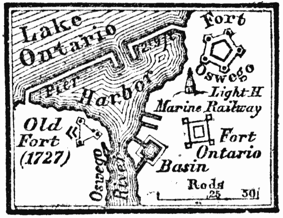
Description: A map of the British forts of Oswego on Lake Ontario, captured by the French in 1756 during the French and Indian Wars.
Place Names: New York, Oswego, �Fort Osweg
ISO Topic Categories: location,
inlandWaters
Keywords: Forts at Oswego, physical, �historical, physical features, other military, location,
inlandWaters, Unknown, 1756
Source: Marcius Willson, History of the United States (New York, NY: Ivison, Blakeman, Taylor, and Co., 1872) 183
Map Credit: Courtesy the private collection of Roy Winkelman |
|