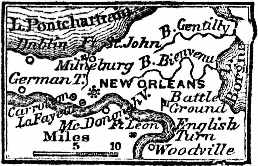
Description: A map from 1872 of the vicinity of New Orleans. "New Orleans, now the capital of the state of Louisiana, is on the E. bank of the Mississippi River, 105 miles from its mouth, by the river's course. It was first settled by the French in 1717. The level of the city is from three to nine feet below the level of the river, at the highest water. To protect it from inundation, an embankment, called the Levee, has been raised on the border of the river, extending from forty–three miles below the city, to 120 miles above it." Wilson, 1872.
Place Names: Louisiana, New Orlean
ISO Topic Categories: inlandWaters,
location
Keywords: Vicinity of New Orleans, physical, physical features, inlandWaters,
location, Unknown, 1872
Source: Marcius Willson, History of the United States (New York, NY: Ivison, Blakeman, Taylor, and Co., 1872) 291
Map Credit: Courtesy the private collection of Roy Winkelman |
|