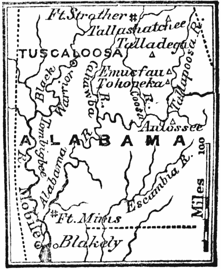
Description: A map of central and southern Alabama showing the major sites of the Creek War or Red Stick War of 1813–1814, including Fort Mims, Alabama River, Tallapoosa River, Fort Strother, Tallashatchee, Talladega, Emucfau, Autosee, and Tohopeka, near the site of the Battle of Horseshoe Bend.
Place Names: Alabama, Tuscaloos
ISO Topic Categories: boundaries,
intelligenceMilitary,
inlandWaters,
location
Keywords: Seat of the Creek War, physical, kNativeAmerican, physical features, boundaries,
intelligenceMilitary,
inlandWaters,
location, Unknown, 1813
Source: Marcius Willson, History of the United States (New York, NY: Ivison, Blakeman, Taylor, and Co., 1872) 313
Map Credit: Courtesy the private collection of Roy Winkelman |
|