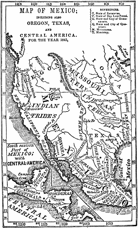
Description: A map of Mexico in 1845, prior to the ceding of the northern territories to the United States in 1846. The map shows the territories of Oregon, Texas, and Central America under Mexican control, and the frontiers of the Missouri and Indian territories. The map shows mountain systems, rivers, cities, forts, and settlements at the time. The states and territories of Mexico are shown, including Oregon, New California, Old California, and New Mexico in the north. An inset map details the Central American portion of Mexico at the time, showing the territories of the Yucatan, Chiapas, Guatemala, Honduras, San Salvador, Nicaragua, and Costa Rica.
Place Names: A Regional Map of North America, United States, �Mexico, �Canad
ISO Topic Categories: inlandWaters,
location,
oceans,
boundaries
Keywords: Mexico and Western North America, physical, �political, physical features, country borders, inlandWaters,
location,
oceans,
boundaries, Unknown, 1845
Source: Marcius Willson, History of the United States (New York, NY: Ivison, Blakeman, Taylor, and Co., 1872) 351
Map Credit: Courtesy the private collection of Roy Winkelman |
|