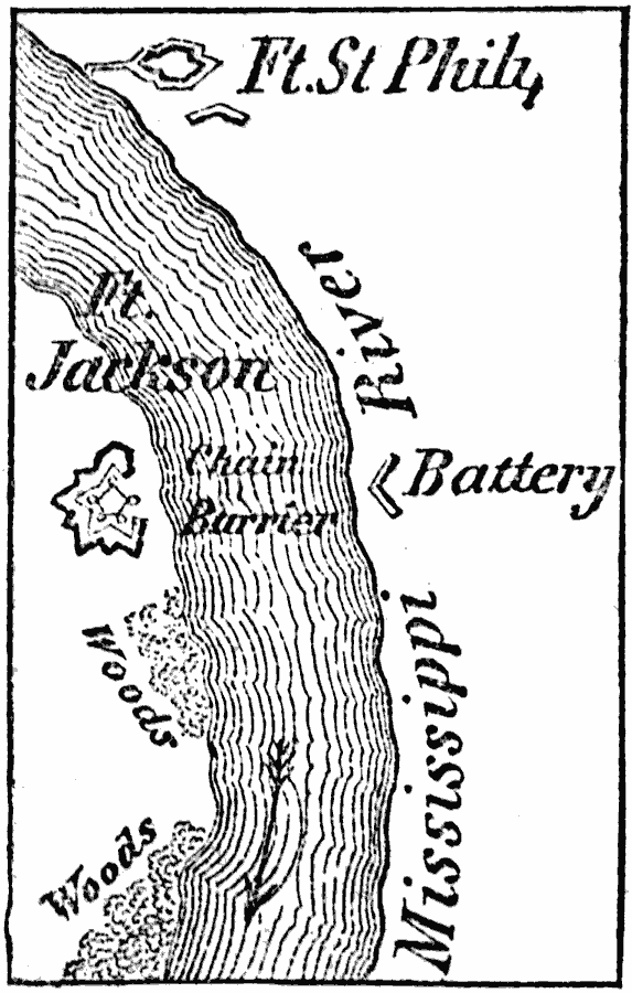
Description: A map of Fort St. Philip and Fort Jackson on the Mississippi River south of New Orleans. These forts were a first line of defense for the city during the American Civil War, and in April, 1862, fell to the Union. The map shows the site of the chain barrier and Confederate batteries.
Place Names: Louisiana,
ISO Topic Categories: structure,
intelligenceMilitary,
inlandWaters,
location,
society
Keywords: Forts St. Phillip and Jackson, physical, �historical, physical features, Civil War, structure,
intelligenceMilitary,
inlandWaters,
location,
society, Unknown, 1862
Source: Marcius Willson, History of the United States (New York, NY: Ivison, Blakeman, Taylor, and Co., 1872) 402
Map Credit: Courtesy the private collection of Roy Winkelman |
|